Key Biking Terms
These are common terms used around the Arlington County biking community.
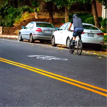
Bicycle Lanes
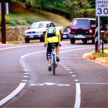
Bicycle Lanes are striped or otherwise separated areas on the roadway designated for the preferential use of bicyclists over motor vehicles. On most streets, bicycle lanes are located between the curb and the right travel lane, or between the curbside parking lane and the right travel lane. Bicyclists are not required to ride in a bicycle lane if one is available. Bicyclists are permitted to ride on the roadway in the bicycle lanes or with mixed traffic, even if a bicycle lane is available. A cyclist may choose to ride outside the bicycle lane if the lane is blocked, or if they feel unsafe riding in the lane for any reason. Cyclists should take the lane if it is the safer option. Motorists may not drive, stop or park in a bicycle lane. Drivers may cross a bicycle lane to access on-street parking but may not stop or stand in a bicycle lane for any reason. When making a right turn from a street with a bicycle lane, drivers should check their mirrors and merge into the bicycle lane to make their turn. This maneuver helps reduce the likelihood of so-called “right-hook” collisions, where a driver turns right across a bicycle lane and strikes a cyclist in the bicycle lane. Regardless of why a driver is crossing a bicycle lane, drivers must always yield to bicyclists when crossing a bicycle lane. There are many criteria that inform the decision to install a bicycle lane or other bicycling facility. First and foremost, the street must be wide enough to accommodate the bicycle lane, in addition to the regular travel lanes. Since Arlington does not have a dedicated program to rebuild roadways specifically to install bicycle facilities, engineers must work within the existing roadway dimensions. As a rule, if it is possible to install a bicycle lane or other bicycle facility on a roadway, Arlington will make every effort to do so in order to make cycling safer and to encourage more people to bike more often.
Bike Boxes
A bike box is a designated area at the head of a traffic lane at a signaled intersection that provides bicyclists with a safe and visible way to get ahead of queuing traffic during the red signal phase. One example of a bike box in Arlington can be found at the southern side of the intersection of Veitch Street and Langston Boulevard in Courthouse. It is particularly useful for improving interactions between people in cars turning right from Veitch Street onto Langston Boulevard and people on bikes going straight on Veitch to get to the Custis Trail. When the traffic light is yellow or red, bicyclists should enter the bike box from the approaching bike lane and stop before the crosswalk. Once a cyclist is in the bike box, they should position themselves according to the direction they are intending to go. Cyclists turning left should move to the left of the bike box and signal a left turn. Cyclists proceeding straight through the intersection should position themselves in front of the through lane. Cyclists turning right should move close to the right edge of the roadway and signal a right turn. When the light is green, cyclists may proceed as normal but should be aware of right-turning motorists, especially while in the green bike lane in the intersection. For motorists, when the traffic signal is yellow or red, vehicles must stop behind the white stop line and not top of the green bike box as it should be kept clear for cyclists to use. Typically at bike box locations, right turns on red are not be permitted. When the light turns green, motorists and cyclists may move through the intersection as usual, with cyclists going first. Motorists turning right on green should signal and watch for cyclists to the right, especially in the green bike lane in the intersection.
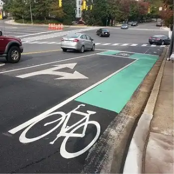
Buffered Bike Lanes
Buffered bicycle lanes function as standard bicycle lanes with the addition of marked buffer space on one or both sides of the lane. Depending on the location, there may be buffers between the bicycle lane and the travel lane, between the bicycle lane and on-street parking, or both. The buffered bike lane offers a more comfortable riding environment that is consistent with Arlington’s “complete streets” policy of maximizing the utility and safety of our streets for all road users. The addition of buffered bike lanes is part of Arlington’s ongoing commitment to make the County a bike-friendly community where cycling is a safe, convenient, and enjoyable form of transportation and recreation. Drivers should treat these lanes the same as any other bicycle lane. Drivers should only cross these lanes when turning or parking, and drivers should never stop, stand, or park within a bicycle lane. To parallel park, a motorist may position themselves temporarily as one normally would, outside of the parking area, to enter the parking space. It is okay to make those maneuvers within the buffered bike lane area.
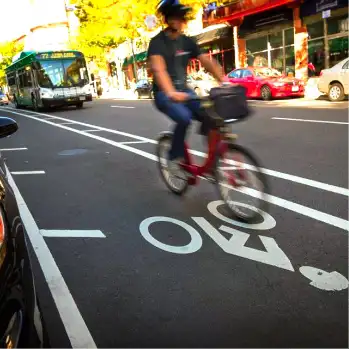
Green Bike Lanes
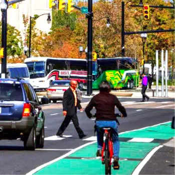
Green bikes lanes (literally, green paint within the existing bike lanes) help reinforce the presence of the bike lane in places where the street markings might not get noticed by drivers. Arlington County has started using them at specific, critical locations where bike lanes and drive lanes cross each other in unusual configurations, such as at “Y” intersections or at the start of some dedicated right turn lanes. The green coating, called “StreetBond CL” was created to hold up well to traffic wear and tear. It is also engineered to maintain the same or higher levels of friction as the asphalt itself. This is an important safety consideration for cyclists, particularly in wet weather. New York City has been using this product (and this color) to mark bike lanes for several years.
HAWK Beacons
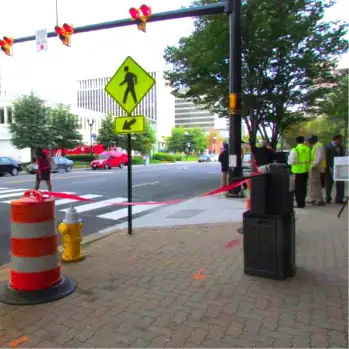
A HAWK beacon (High-Intensity Activated Crosswalk) is a device to help pedestrians and cyclists safely cross busy streets. While they are different in appearance to motorists, to the pedestrian or cyclist, HAWKs work the same as button-activated traffic signals. The HAWK stops traffic with a red light, allowing pedestrians and cyclists to cross safely. At rest, HAWKs remain dark. A HAWK can be triggered automatically or manually with a push button. It will then go through a series of yellow and red sequences requiring motorists to slow down and stop. After pedestrians and cyclists cross, the HAWK will go dark again, allowing motorists to continue through the intersection. HAWK beacons can be installed at mid-block locations or at an intersection of an arterial road with a smaller side street. Unlike a standard traffic signal, intersections with HAWK beacons do not have any traffic signals facing the side street approaches. Any side street that is currently controlled by a stop sign will continue to be controlled by a stop sign even after a HAWK beacon is in place.
Multi-Use Trails
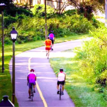
Arlington County has an extensive network of bicycle infrastructure, including approximately 50 miles of shared-use, off-street trails. These multi-use trails are generally 10 feet wide with a solid yellow line striped down the middle to separate users. Trails are used by people engaging in a variety of activities, including pedestrians, dog walkers, runners, and people on bikes. All users should stay to the right and pass when clear, after giving an audible warning. When walking a dog on a multi-use trail, trail users should be considerate of others and not allow the leash to extend across the travel lane. Cars and other motor vehicles are prohibited from operating on the off-street trails. To report a problem or maintenance issue on Arlington’s trails, use the Request Service/Report a Problem tool or call 703-228-6525. For the W&OD Trail, contact NOVA Parks at 703-729-0596.
Protected Bike Lanes
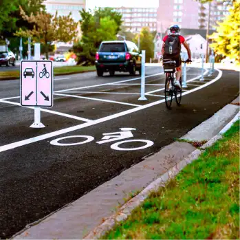
Protected bike lanes, also known as cycletracks, green lanes, and separated bike lanes, provide physical separation between bicyclists and motor vehicles. This separation can be achieved in several ways, such as using plastic bollards or "flex posts," landscaping and large planters, curbs, or car parking. Arlington's first protected bike lanes were installed in 2014. Many other successful examples of protected bike lanes can be found across the country, including in cities like New York, Chicago, San Francisco, Austin, Memphis, and Indianapolis.
Sharrows
Shared-lane markings or “sharrows,” are intended to help motorists and cyclists safely share and navigate streets. Sharrows show cyclists where to be in the road (aligned with the middle of the chevron markings). Along with “Bikes may use full lane” signs, they remind drivers to expect bicyclists. Sharrows are different from bike lanes, which are reserved exclusively for bicyclists and are marked by a solid white line and a bicycle symbol. They also show where cyclists can ride on the street without risking being hit by a car door being opened. Although it is the responsibility of the motorist to check before opening their door, riding too close to parked cars (in the “door zone”) remains a common mistake bicyclists make and one that can lead to serious injury.
Sidewalks
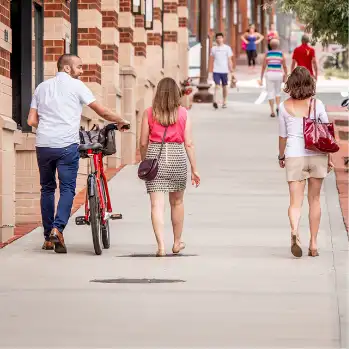
A sidewalk is defined as the portion of a street between the curb lines, or the lateral lines of a roadway, and the adjacent property lines, that is intended for use by pedestrians. In Arlington County it is legal for a person or a bicycle to use a sidewalk, unless it is signed as prohibited. Bicyclists and other users on sidewalks, shared-use paths, and crosswalks have all the rights and duties of a pedestrian under the same circumstance. It is best for bicyclists to avoid riding on sidewalks unless there is truly no other safe way to continue riding on a particular street segment. This behavior increases the chances of a collision with pedestrians, so any riding on a sidewalk should be undertaken with great caution, and at slow speeds, particularly if pedestrians are present. Riding on the sidewalk can also increase the chance of a collision with a car at an intersection, particularly if the cyclist is crossing the street from the sidewalk and is riding against the flow of traffic. Motorists may not be expecting a bike to appear.
Wayfinding
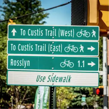
Arlington County has placed directional wayfinding signs along bicycle and pedestrian routes throughout the County. These wayfinding signs help cyclists and pedestrians navigate Arlington’s 100 miles of multi-use trails, on-street bike lanes, and designated bike routes, as well as its commercial districts. The system conforms to national standards for directional signage and uses similar materials, layouts, and fonts as roadway signs to increase visibility. Frequent spacing of signs increases cyclist and pedestrian confidence in unfamiliar areas, and each sign reinforces location, distance, and destination information.
Sign location placement guidelines include:
Major Destinations and Routes: Direction in Arlington is often established by major destinations, like urban villages such as Rosslyn, Ballston, and East Falls Church. Similarly, signing corridors, such as the Custis Trail, also help establish direction.
Neighborhoods and Local Destinations: Smaller signs, sorted by direction (straight, right, or left) and by distance (near to far), act like “breadcrumbs” and are placed at junctions where one must decide which direction to take.
Strategic Signage: To minimize sign clutter and maintenance costs, only the most popular and/or useful destinations have been chosen as to not “over-sign” or contribute to sign clutter.